Although Denver’s current short-term BRT plan fails to include the Speer/Leetsdale/Parker corridor, there is an opportunity for change through Arapahoe County’s study of the Parker Road segment of the corridor. We encourage community members to call for BRT on the corridor sooner rather than later, by e-mailing comments to the project team at jkatzer@arapahoegov.com.
By Jason Schaefer
The Denver region is gearing up for transformative Bus Rapid Transit (BRT) investments. By 2050, at least eight corridors will evolve into BRT corridors, featuring faster and more frequent service, modern stations, level boarding, and more—offering the benefits of light rail at a fraction of the cost.
In its current stage of construction (2020–2029), DRCOG’s Regional Transportation Plan prioritizes BRT on three corridors: East Colfax, Colorado Blvd, and Federal Blvd. These corridors have high ridership on their existing buses and serve people who rely on transit. They are great candidates for being upgraded to BRT. However, one crucial corridor that could tie the entire network together is missing from the plan’s current stage.
That corridor is the Speer/Leetsdale/Parker corridor extending from Nine Mile Station at I-225 west to Federal Blvd. BRT on the corridor is currently slated for the 2030–2039 stage in DRCOG’s 2050 Regional Transportation Plan. A closer look at the corridor reveals that it should be prioritized and moved into the current stage.
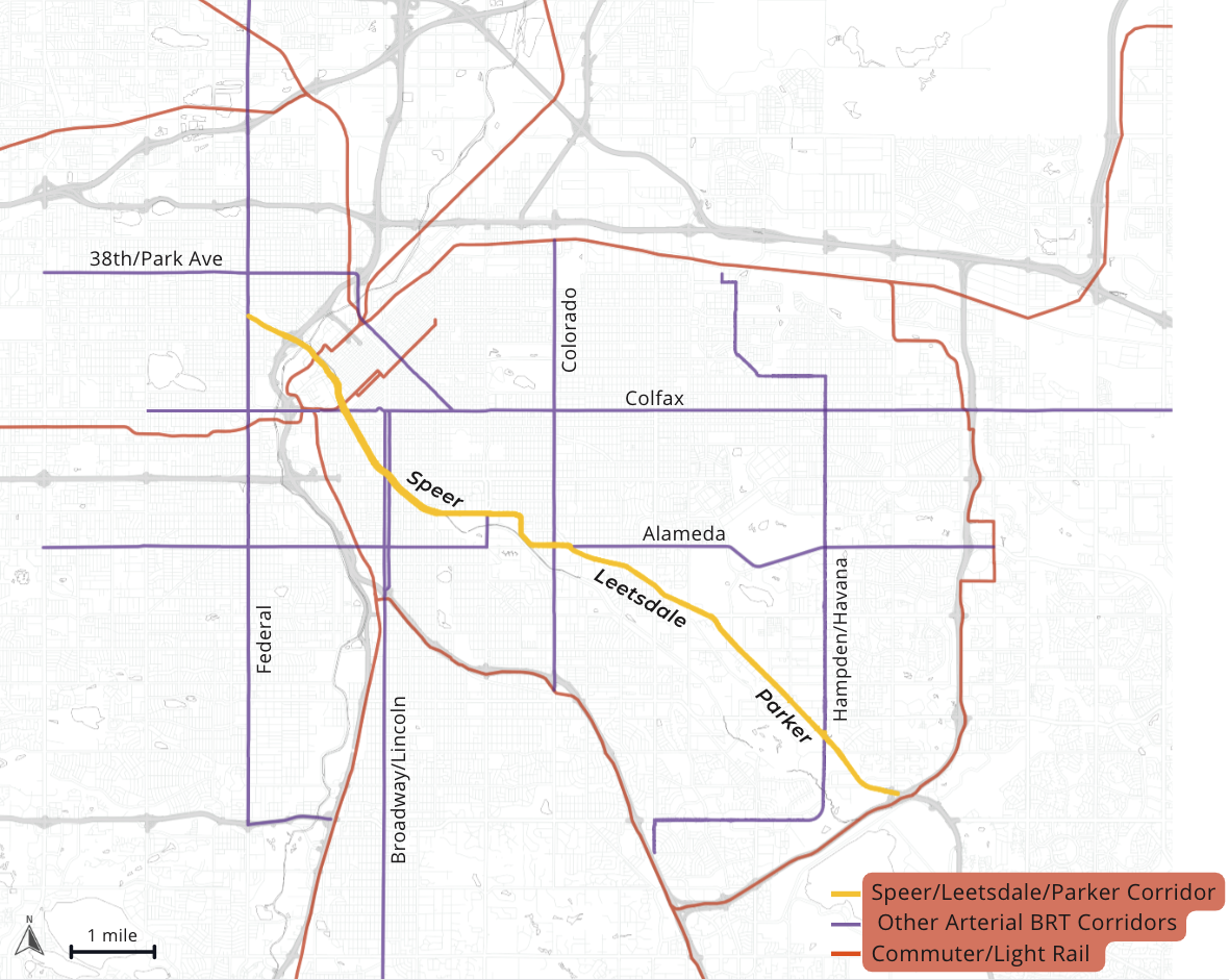
Connecting Denver’s Rapid Transit Network

Source: Jason Schaefer, HDR, UrbanFootprint
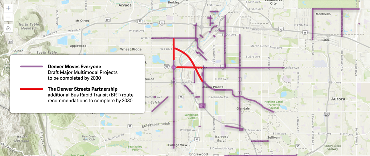
Extending BRT to Federal Blvd, as proposed by the Denver Streets Partnership, would maximize its connectivity. This extension would integrate the Speer/Leetsdale/Parker corridor with the current Federal BRT plan, while serving downtown and key destinations such as Ball Arena, Elitch Gardens/River Mile, the Convention Center, the Denver Performing Arts Complex, and the Auraria Higher Education Center.

Map shows how extending the Speer/Leetsdale/Parker and Colfax BRT lines would create a connected network (Source: the Denver Streets Partnership)
Opportunity to Advance Equity
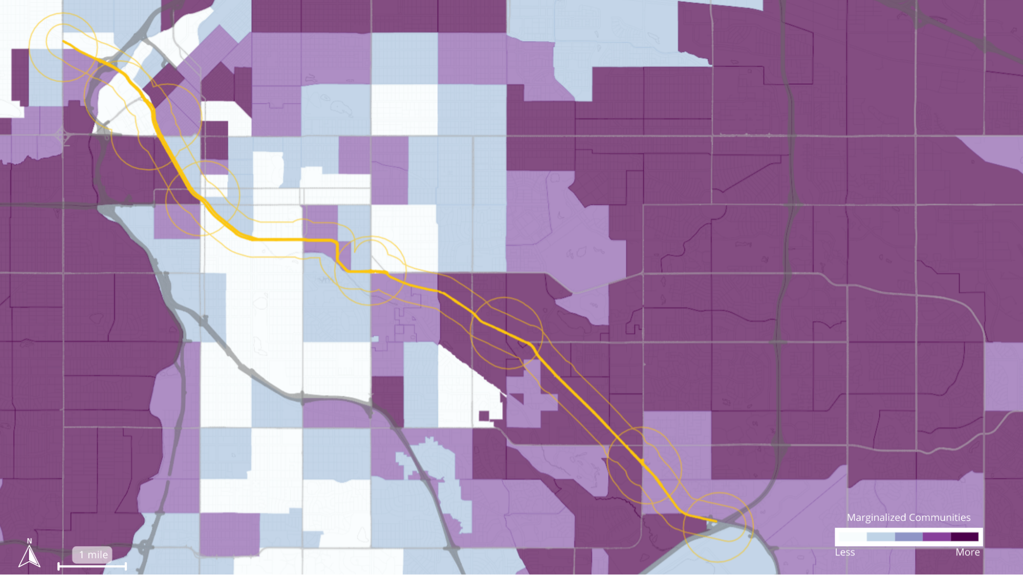
The Speer/Leetsdale/Parker corridor serves marginalized communities like Kennedy, Windsor, and La Alma/Lincoln Park. DRCOG’s Equity Index finds:
- 29% of corridor census tracts are in the top quartile of marginalized communities in the region
- 31% of the corridor’s population is in the top quartile
- Mean equity index score: 26.2 on the corridor compared to 25.7 for the region

Source: DRCOG’s Equity Index
The corridor also boasts a nationally recognized array of culturally rich and diverse restaurants, particularly around Parker Rd and Havana St. A proactive plan to prevent displacement is crucial, especially for small businesses and cultural institutions.
Addressing the Housing Crisis
Within a quarter mile of the corridor and half a mile around major transit stations, there is potential for over 80,000 additional housing units, or over 40,000 units if only including the most readily developable parcels (those with an improvement-to-land value ratio of <1.0). Rapid transit service along the corridor with easy access to the rest of the network would make it a great place to live.

Source: Jason Schaefer, HDR, UrbanFootprint
A Climate Solution
Transportation is the largest source of emissions in our region, responsible for 34% of greenhouse gas emissions. By developing compact housing near transit stations and BRT corridors, we can significantly reduce climate pollution. According to modeling by DRCOG, concentrating housing and jobs around key centers and corridors, combined with transit investments, was the only scenario that met all three Metro Vision 2050 Regional Transportation Plan targets: minimizing travel delay, reducing vehicle miles traveled, and decreasing single occupancy vehicle use.
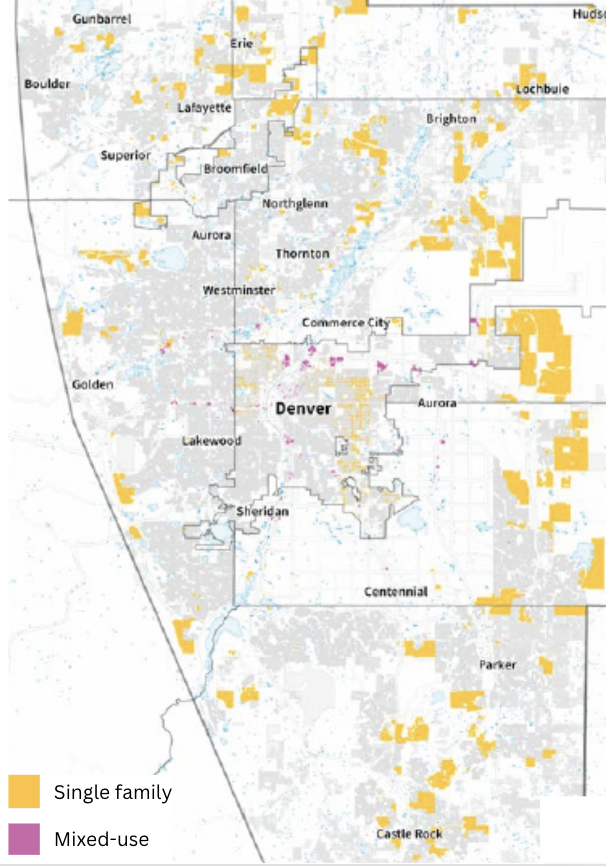
In contrast, if we continue our current development pattern, it will consume 60,426 acres—the size of a medium-sized city, according to RMI.

The business-as-usual scenario (Source: RMI Urban Land Use Reform report)
In Conclusion…
Given its strategic significance, the Speer/Leetsdale/Parker BRT project should be expedited and moved up to the 2020–2029 staging period of DRCOG’s Regional Transportation Plan. This corridor intersects with existing and planned rapid transit lines, serves marginalized communities, and provides vital access to educational institutions and major employment centers. Accelerating this project would significantly enhance mobility for residents and support economic opportunities.
