
Denver’s Main Streets
Transforming Denver’s Main Streets into people-first corridors is one of the most powerful ways to improve safety, expand transportation options, support local businesses, and build a more equitable and vibrant city.
Denver’s Main Streets, including Colfax, Federal, Colorado, Broadway, Lincoln, Speer, and Alameda, are the backbone of our city. They move more people than any other streets, connect residents to jobs and daily needs, are home to many small, locally-owned businesses, and carry Denver’s busiest transit routes.
The map below shows how Denver’s biggest needs and opportunities overlap on these corridors, and why focused investment on Main Streets matters. Together, these layers highlight where change can have the greatest impact:
• High Injury Network (HIN) – These streets account for a disproportionate share of traffic deaths and serious injuries. Many are wide, fast-moving arterials where people must cross up to eight lanes of traffic. Denver’s Vision Zero Action Plan prioritizes safety improvements on these corridors. Learn more about our Vision Zero advocacy.
• Transit Priority Streets – Identified in the Denver Moves: Transit plan, these corridors are key opportunities to improve transit speed, frequency, and reliability. Many already have high ridership or strong potential with better service. Learn more about our transit advocacy.
• Equity Index Areas – These areas face the greatest barriers to healthy living, based on factors such as income, education, access to food and parks, childcare, and health outcomes. Many of Denver’s Main Streets run directly through these neighborhoods.
Pan, zoom and click on the map to learn more about specific Main Streets! Got feedback on the map? Submit it here!
What people-friendly Main Streets look like:
- Safer street designs that reallocate street space to prioritize walking, biking, transit, and green infrastructure (trees, flower beds, native plants) over the speed and convenience of driving
- Dedicated bus and bike lanes and more frequent, reliable transit
- Land use and zoning changes that support mixed-use, affordable, and missing-middle housing, like duplexes, fourplexes, and cottage clusters, near transit
- Investments in public art, trees, and other placemaking that reflects and celebrates the culture of the community
- Policies to support legacy businesses and prevent displacement, especially during and after construction of street safety improvements
- Greater local control over major streets currently designated as state highways
Pictured below: Street design elements from Denver’s Complete Streets Design Guidelines [PDF]

Learn more about what’s happening on specific Main Streets, and how to get involved
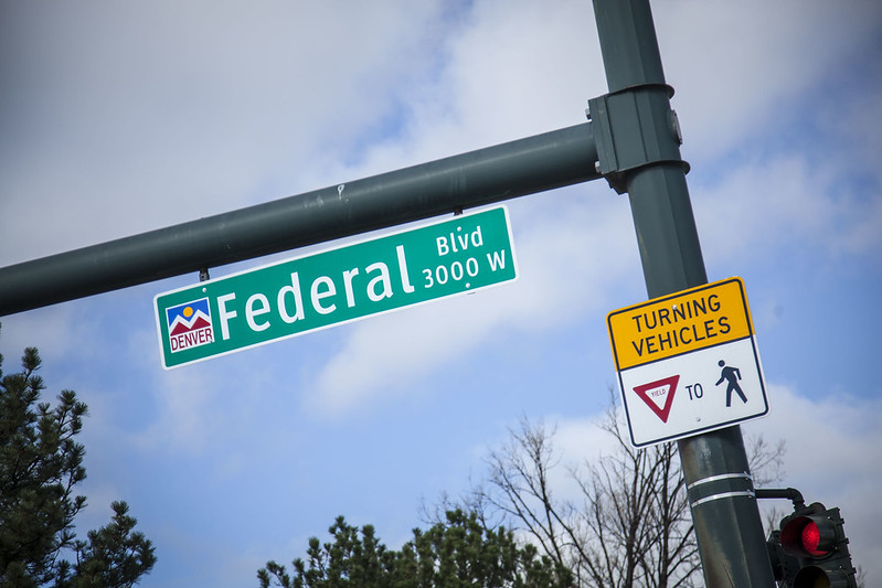
Federal Boulevard
Federal Boulevard is a critical part of Denver’s transportation system. It’s also the deadliest street in the city. It’s time to fix Federal Boulevard.
Colfax Avenue
Denver’s first true bus rapid transit (BRT) line is under construction right now on Colfax, and scheduled for completion by the end of 2027. When completed, the project will demonstrate how a dangerous, highway-style arterial can be transformed into a safe, vibrant, people-friendly street.

Colorado Boulevard
Colorado Boulevard is one of the most important corridors on Denver’s east side. It connects the northern and southern edges of Denver and links the city with Glendale. But today, Colorado Boulevard functions more like a highway through the city than a main street.